
Discover the secret of Hawkcraig Point, and why you should never meddle with a monk, on this short but scenic walk from the coastal village of Aberdour.
Background
The Hawkcraig Admiralty Research Experimental Station, otherwise known as HMS Tarlair, opened in 1915. At the outbreak of the First World War, the German U-Boats were a significant threat to British ships and research began to develop a way to detect them. Hawkcraig was chosen as the location for the navy’s main hydrophone research and training base, which began as a small wooden hut but would soon develop into a site that would train nearly 4000 men.
HMS Tarlair was under the command of Captain Cyril Percy Ryan. Ryan had the support of Admiral David Beattie, Commander in Chief of the Grand Fleet, who took up residence in nearby Aberdour House.
The site of all this military activity must have been a strange experience for the locals, who had to live alongside this secretive place. Yet despite the research centre’s important role, little remains today to show what took place at Hawkcraig Point.
This short walk leaves Aberdour village by its historic harbour, following the coast to reach Hawkcraig and the popular Silversands beach.

The Walk
Distance: 3.5km (2 miles)
Start and Finish: Aberdour Station (NT 19073 85408)
Facilities: Shops and cafes in Aberdour, and a cafe at Silversands beach.
Terrain: Surfaced path, with rough track between Aberdour and Silversands. Steep flight of steps to reach Hawkcraig Point.
Access: Trains from Edinburgh, Kirkcaldy and Dundee stop at Aberdour station. Buses from Kirkcaldy and Dunfermline stop in the village.
This walk starts at Aberdour’s picturesque Victorian railway station (NT 19073 85408). In recent years, the station has won numerous awards including “best small railway station” and “best kept station in Britain”. Since 2017, the station building has been home to the Aberdour Heritage Centre.
If you arrived on a train from Edinburgh, you’ll need to cross to the other platform to begin the walk.
Leave the station, and head out of the car park onto Station Place. You’ll pass the Spence Memorial Clock (NT 19080 85350), erected in 1910 to commemorate a long-serving local doctor. It was moved to its current location to make room for the village war memorial, and until it was electrified in 2006 it was wound by three generations of the same family.

After a short distance, turn left onto Shore Road (NT 19025 85295). Follow this downhill to the small beach known as Black Sands. Turn left and continue along the road until it bends towards the harbour pier. The harbour is private, but a path on your left leads past the harbour (NT 19385 85091).
Aberdour grew up around its harbour, which has existed for centuries. In the 19th Century, a stone pier was built to help handle the vast amounts of coal that left Fife’s collieries for markets around the world.
In the mid-1800s, the village economy changed when it became a popular tourist spot. This led to the arrival of a different kind of boats: pleasure cruises carrying day-trippers from Leith. By the 1890s, as many as nine ships per day ferried passengers across the Forth and the village expanded to take advantage of these new visitors.
Today the harbour is mainly used for leisure. If you visit Aberdour in the summer, you might catch a glimpse of the Aberdour regatta, held by Aberdour boat club each year. The regatta dates back to 1857 — giving you the chance to see share an experience that a Victorian tourist would recognise.

Note: Due to flood damage, the footbridge across the Dour burn is currently out of use. To reach the other side, you should retrace your steps back to Aberdour station, cross the car park and follow the path along the side of the railway line to reach Hawkcraig Road. Turn right, and follow the road to the entrance of Silversands car park. A path on your right leads down some steps to rejoin the coastal path on the other side of the burn. The diversion will add approximately 1.5km to the length of the walk.
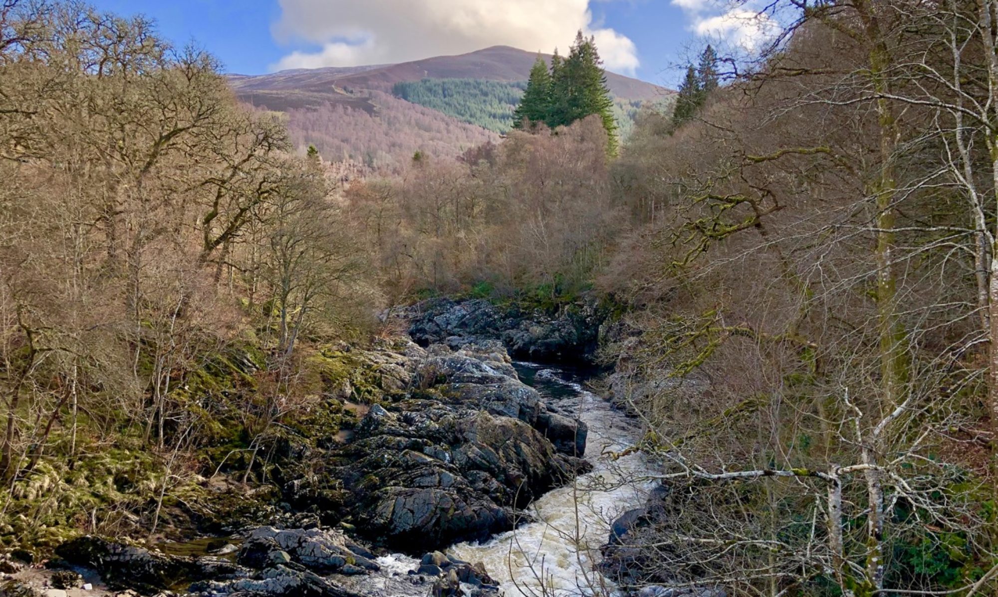
Follow the path away from Aberdour, taking in the fantastic views across the Firth of Forth. On a clear day you can see the picturesque Inchcolm Island with its ruined medieval abbey, founded by King Alexander I in 1223.

Did you know: the stretch of water between Aberdour and Inchcolm island is known as Mortimer’s Deep. William de Mortimer, who was the Lord of Aberdour, got himself into a bit of a quarrel with the monks who lived on the island. In a dispute over the appointment of a new monk, Mortimer was implicated in the beating up of several canons of the nearby church to try to influence the proceedings. Although the two sides settled their argument, the monks seem to have held a grudge: when Mortimer’s body was being transported to the island for burial, they tossed it overboard into the cold, dark sea below.
Continue along the path towards Hawkcraig Point (pronounced like Haw Craig). You’ll soon pass a fence that leads to a whitewashed house. This is Hawkcraig Cottage (NT 19790 84970), once the home of Captain Cyril Percy Ryan who was in charge of HMS Tarlair.
Ahead, you will find the remains of Hawkcraig pier (NT 19803 84851) which reach out into the Forth. The wooden pier was built in the 1860s to allow pleasure cruises to land passengers at Aberdour’s harbour at low tide.

Retrace your steps back to Hawkcraig Cottage. As the track starts to climb gently, a set of stone steps on your right climbs steeply up to the clifftop. From here you have perhaps the most extensive views east on the whole of Fife’s coast, looking towards Burntisland and the wooded rise of The Binn, the small hill that overlooks the town. Cross the point, then descend steps to what was once the site of the secretive HMS Tarlair (NT 20105 84925).

Follow the road towards the vast expanse of sand at Silversands beach (NT 19930 85240). The name was coined in the last century in an attempt to drum up tourism — it certainly worked, as the beach is one of the most popular in the area.

Follow the road along the edge of the beach until you pass a cafe (NT 19990 85470). The Fife Coastal Path leads towards the railway line here, but bear left to join a path that leads past another whitewashed cottage. This turns into a broader track that crosses the green, passing a football pitch before arriving at Hawkcraig Road (NT 19570 85385).

Turn right and follow the road until you arrive at a bridge (NT 19355 85550). Descend the short flight of steps at the left of the bridge to reach a path that shadows the railway line. Follow this past Aberdour castle to arrive back at the railway station (NT 19073 85408).

Aberdour Castle is thought to be one of the oldest standing castles in Scotland. It was built in or around the year 1200 by the de Mortimer family, who had owned the land since the 1120s.
In 13th Century, King Robert the Bruce granted the castle and lands at Aberdour to his nephew, Thomas Randolph, the Earl of Moray. By the middle of the century, however, it came into the ownership of the Douglases. It became the seat of the Earls of Morton when James Douglas married Joan Stewart, the daughter of King James I, in 1458. It was the Earls of Morton who were responsible for much of the enlargement of the castle.
The castle was heavily damaged by fire in the late 17th Century, and again by a second fire in 1715 when government troops garrisoned the castle during the Jacobite Rebellion. Attempts were made to restore the castle, but in 1725 the Mortons purchased Aberdour House and the castle ceased to be a residence. It was used for a number of purposes over the following years, until it entered state ownership in 1924. Today the is in the care of Historic Scotland — please check their website for opening times and prices.
Discover more
Much of this walk followed the course of the Fife Coastal Path, the 116-mile-long trail that runs along the Fife coast from Kinkardine to Newburgh.
You can extend this walk at Silversands. Instead of leaving the Fife Coastal Path at the end of the beach, you can continue to follow the route to Burntisland, a distance of around 3.5km, where regular trains can bring you back to Aberdour.