
Discover Fife’s industrial heritage, and the lost village of Binnend, on this linear walk to the summit of The Binn from Kinghorn to Burntisland.
Distance: 8km (5 miles)
Start: Kinghorn Railway Station (NT 269 868)
Finish: Burntisland Railway Station (NT 232 856)
Access: Regular trains stop at Kinghorn and Burntisland. Both towns are also connected by bus from Kirkcaldy.
Terrain: Pavement and road crossings at either end of the route. Sturdy farm track and path to The Binn, with some gates and stiles. Rough path descends from the summit to reach Burntisland.
Background
I’ll admit that when I started this walk, it wasn’t quite what I was expecting. I don’t mean that route was a strange one, or that the journey there was particularly arduous. I’m talking about one thing that every walker knows all too well: the weather.
When I boarded my train from Edinburgh to Kinghorn, on the Fife coast, it was a beautiful sunny day – so much so that I’d made the bold decision to wear a t-shirt, shorts, and even my sunglasses. As I crossed the Forth Bridge, I could see the clouds gathering and by the time I arrived in Kinghorn there was no trace of the hot mid-August afternoon I had left behind. I was starting to think I’d made a bad decision.
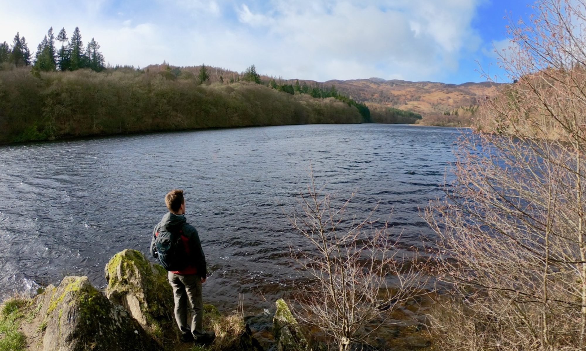
It didn’t take long before the sun broke through and brightened my spirits, and I was rewarded with fantastic views from the top of The Binn. It may be a rather small hill, but, as I gazed across the Forth towards the Pentland hills that peeked out over the thick blanket of cloud, it felt like I was atop a great lochside mountain somewhere in the Highlands. What more could you ask for?

The Route
This walk starts at Kinghorn station, which is well served by regular trains between Edinburgh and Kirkcaldy.
Leave the station and head uphill to join Burntisland Road. Turn left here, and follow the road towards Kinghorn golf club. Once you reach the access road to the clubhouse (NT 26714 86660), leave the road and follow the track as it winds uphill to cross the course itself – be sure to take care for any stray golf balls.

At the other side of the golf course, the track bends to the right near Pettycur caravan park (NT 26095 86550), with views down to the beach below. Continue along the track, passing the entrance to Grangehill House, until you reach the half-derelict Grangehill Farm (NT 25890 86740). A gate here leads around the side of the farm buildings.
You will soon pass Kinghorn Loch on your right. The loch was once heavily polluted, but today it is a wildlife conservation area.
The path bends to the left, with views of The Binn straight ahead. Continue until you reach the back road between Kinghorn and Burntisland (NT 25190 87295). Turn left, and follow the road for a short distance until you reach a path on your right signed for The Binn (NT 25140 87260).

Follow the path as it leads away from the road. On your right is an area known as Whinnyhall: between 1944 and 2002, this was the dumping site for the waste (known as “Red Mud”) that was produced by the Alcan Chemicals factory at Burntisland. It was this waste that was responsible for polluting Kinghorn Loch. Further ahead you will pass the ruined village of Binnend (NT 24090 87175), obscured by the trees.
Binnend village was built in 1881 to house workers from the nearby shale oil works. It had a population of around 560 people, crammed into only 94 homes. After the oil works closed in 1893, the village’s population began to decline. During the First World War it was occupied by troops, and after the war it provided a home for many workers at the Burntisland Aluminium factory.
The village never truly recovered, and during the interwar years it mainly served as holiday homes for visitors from Edinburgh and Glasgow. Not connected to water, gas, electricity, or sanitation, rising standards of living meant that the village was closed in the early 1930s. As time passed, the waste from the aluminium plant slowly covered the village, hiding any trace of the once-thriving village that once was.

From Binnend, the path begins to climb uphill. You will need to cross a stone wall, though thankfully there is a stile. Looking ahead on your right, you will have a clear view of the Craigkelly mast that stands tall on the hilltop. Before long, you’ll arrive at the summit of The Binn (NT 2353 8693) with the town of Burntisland below.
At 193 metres (632 feet), The Binn is by no means among Scotland’s highest hills. Its name isn’t particularly grand, as it simply means “the hill” (it comes from the same origin as the “Ben” in Ben Nevis or the “Pen” in Pen-y-Ghent). From your position on its summit, you can see many hills that are far higher – and far more challenging walks. Yet The Binn, with its fine views south across the Firth of Forth and north towards the Highlands, manages to feel very grand.

From the viewing point, follow the path along the ridge. The path bears right – almost indistinctly – to descend towards Binn Pond (NT 22675 86990). Past the pond, you will pass through a gate and follow the path through the trees. You’ll soon reach a fork in path: bear right and continue until you reach the A909 which connects Burntisland and Cowdenbeath (NT 22160 86640).
Note: the path ahead requires you to descend a series of rough, narrow steps. You can take an alternative route to Burntisland by turning left and following the road until it meets Burntisland High Street (a distance of around 2 km / 1 ¼ miles).

Cross the road and follow the path along the edge of a field. On the other side of the field, descend the steps and follow the somewhat overgrown path to emerge onto Bendameer Road (NT 22365 86470). Follow this to reach Aberdour Road. Turn right, and follow the road to the junction with Kirkton Road (NT 23060 86265), which leads to Burntisland’s High Street (NT 23160 85805). From here, you can either catch a train at Burntisland Station (NT 232 856), or follow the Fife Coastal Path back to Kinghorn.
Tucked behind the High Street on East Leven Street stands the Parish Church of St Columba (NT 23350 85712). Not only is it the oldest post-Reformation church still in use, it was also the meeting place of the General Assembly of the Church of Scotland in in 1601 with King James VI present (who, two years later, became James I of England). It was at this meeting that he was convinced to produce what would go on to become a moderately successful publication: the King James Bible.
More options
The Fife Coastal Path runs through both Kinghorn and Burntisland, offering miles of coastal walking.
Burntisland was the site of the world’s first seagoing roll-on roll-off ferry, used to transport railway carriages across the Forth to Granton in Edinburgh. A similar ferry was also used at nearby Queensferry – which you can discover in a walk across the Forth Road Bridge.