
Castlelaw may not be one of the highest hills in the Pentlands, but it has panoramic views across the Lothians. Journey through picturesque valleys to visit a well-preserved Iron Age hill fort on this 12km walk from Bonaly.
Distance: 7 ½ miles ( 12 km)
Start and Finish: Bonaly car park (NT 21140 67460)
Access: Limited parking at Bonaly car park. Bus 10 terminates at Bonaly, leaving around 1km to the start of the walk.
This walk can be started from Bonaly, allowing for access by public transport: follow Bonaly road south across the City Bypass, continuing straight ahead to pass Bonaly Tower. After passing the scout centre, you will soon arrive at the car park.

At the car park, start by heading through a gate (NT 21140 67460) next to an information board and climb gently uphill following a path signed for Glencorse. You’ll pass through a small area of woodland, after which a gate leads onto open moorland. The path roughly shadows the Dean Burn, which flows below you to your left. When the path begins to level, you’ll arrive at Bonaly Reservoir (NT 21170 66310). The reservoir was built in the 19th Century to supply drinking water for the growing population of Edinburgh and to make sure there was a constant supply of water for the nearby mills.

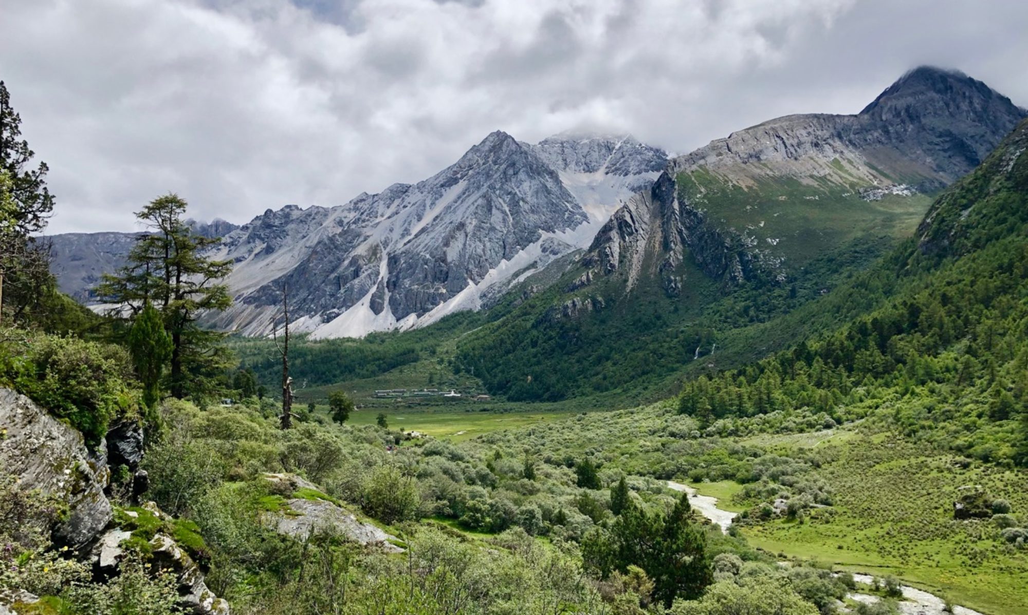
Pass the reservoir to reach a gate at a junction with another path (NT 21190 66090). Bear right, signed for Glencorse, and follow this particularly muddy route along the edge of the woodland. After a short distance, the path starts to bend left to leave the trees behind and enter Phantom’s Cleugh.
The path winds through the cleugh between Capelaw and Harbour Hill. Many small streams emerge from the hillsides, which feed both Bonaly and Glencorse reservoirs: this means the ground can become very wet. You’ll need to cross one of these streams at a small wooden bridge.

As you begin to emerge from the Cleugh, you’ll descend across Knightfield Rig to reach another path signed for Flotterstone (NT 21400 64230). Follow this path out of Maiden’s Cleugh to reach the edge of Glencorse reservoir (NT 21570 64045).
Glencorse reservoir was built in the 1820s to power the mills on the River Esk. Today its water is treated at a nearby water works (along with that of Talla, Fruid, and Megget reservoirs) to provide drinking water for the people of Edinburgh and West Lothian. Beneath the water’s surface are the 13th Century ruins of St Catherine’s Chapel, which was built when Sir William St Clair won a bet with King Robert the Bruce – although this may not qualify it to be called “Holy Water”! The existence of this chapel is reflected in the names of the Kirk Burn that feeds the reservoir, and the Kirk Bridge that crosses the burn.

Bear left and follow the reservoir for a short distance, crossing the Kirk Bridge as the road bends. You’ll soon reach a path that climbs uphill on your left signed for Castlelaw (NT 21920 63930). Join this path between a drystone wall and some trees, then bear right when you reach another path at the end of the trees (NT 22030 64120). From here, you have fine views across the reservoir.
This stretch of the walk borders the Castlelaw Military Firing Range. You shouldn’t have any issues provided that you stick to the paths, but take care when passing the ranges and give way to any military vehicles you may encounter. If red flags are flying, this means that firing practice is taking place.

After around 1km, the path leaves the main track in order to avoid Castlelaw farm. A footpath to your right leads through a small area of woodland to emerge at Castlelaw car park. Cross the car park and pass through a gate to reach Castlelaw hill fort.
The hill fort at Castlelaw is one of four in this part of the Pentlands: the other three are at Hillend, Lawhead and Camp Hill. It is in the care of Historic Scotland: this means you’re free to wander around its ancient ramparts. The fort dates from the Iron Age, and the people who once lived here were part of a farming community, and the fort served as their defence against bandits and rival tribes. Fragments of pottery found during archaeological digs show signs of trade between the local inhabitants and the Romans.
The earth house (also known as a soutterain) within the fort’s walls was built in the 2nd century. It’s not clear exactly what it was built for: for trade? As a hiding place? Or perhaps as part of a ritual? Why not enter and find out for yourself.

Follow the stony track uphill. If you make a short detour here to the top of Castle Knowe, you’ll have a fine view of the hill fort and the hills beyond. Return to the main path, which continues towards the eastern side of Castlelaw Hill.

When you reach a junction on your left (NT 22740 64960), join this and follow track to the top of Castlelaw Hill (NT 22471 64782). The path to the summit (488m) is quite steep, but the view from the top more than makes up for it.

Return to the main path via the same route, and follow it north across Fala Knowe. Its name comes from Falaw, which is Scots for “speckled hill“. Falaw was once the name of Castlelaw, but over the years the name has come to refer to the otherwise unremarkable mound.
As you pass between Allermuir and Capelaw hills, join a well-worn path on your left that leads to a stile (NT 22267 65997). Cross the wall here, then bear right to join a path leading around the north face of Capelaw Hill.

The path here is clear and well-walked, but can be wet after poor weather. It’s all too easy to lose yourself in the wide views across the city, only to find yourself knee-deep in mud.

Shortly after the path bends sharply right, you’ll reach a junction. Bear left to return to the gate leading to Bonaly reservoir (NT 21190 66090). Pass back through the gate and retrace your steps past the reservoir and downhill towards Bonaly for a well-earned rest.