
I ventured into the land of the dwarves for a walk around the hills of Simonside. Rocks, trees and moorland galore!
Distance: 7.5 miles (round trip)
Time: 3 ½ hours
Starting from the Lordenshaws car park to the south of Rothbury, I initially set off in the wrong direction – quite intentionally, I’d like to add! With the Simonside hills to my rear, I headed along St Oswald’s Way for a short distance until I reached a fork in the path. Off to the left was a large stone with fine examples of prehistoric rock art while to the right was Lordenshaws hill fort, both of which offered fine views across to Rothbury.


Returning to the car park I headed to the right down the road leading to back to Rothbury. After crossing a cattle grid, I left the road at a large sign for Simonside and followed the green arrowed Forestry Commission trail into the woods. This soon met a red arrowed trail that crossed a parking area and proceeded to climb steadily uphill along a wide and well-surfaced trail.

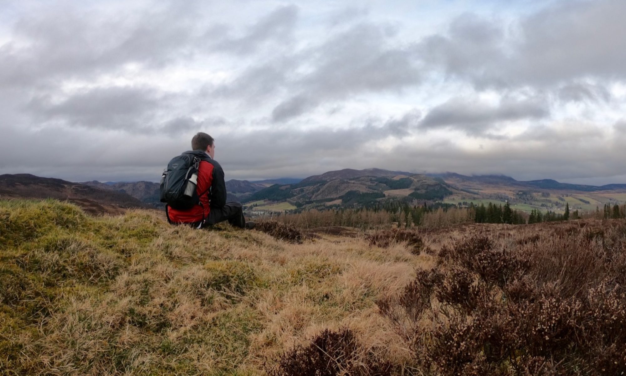
After a while, I reached a deforested area with views up to the hills on my left. I immediately turned in here, passing between two rocks and onto a narrow, overgrown path. This led to Little Church Rock – not in fact a Christian rock group, but a large rocky outcrop that may have been used for religious purposes several thousand years ago. A quick scramble led to the top where I sat and gazed out over the woodland below me.


Heading back to the main path, I continued along until the red arrows headed on to a sandy, stony path that passed through the heather and bracken. Red arrows pointed to the left, but I continued straight on until the path levelled out. At this point, with Simonside in view, I made a detour to the right. Continuing across a trail once the path came to an end, I passed through a gate and aimed towards a cairn.

Heading to the right and across the heather, a sheer drop suddenly appeared before me at Ravens Heugh. From here, I could see right across the Coquet valley towards the Cheviots. I wasn’t the only one enjoying the views – the site is popular with climbers, and there were several ropes hanging down over the edge.

I returned to the path and headed towards Simonside itself. Rejoining the red arrowed route, I climbed the stone steps to the top of the hill with its large cairn. These hills are supposedly inhabited by the Duergar, a race of malevolent dwarves who appear at night to lead unsuspecting travellers to their deaths. Luckily for me the sun was still high in the sky!


The path here is clearly marked by large flagstones, so it was just a matter of following them across Old Stell Crag and then Dove Crag. When the red arrowed route started to head downhill after Dove Crag, I followed the yellow arrows across the ridge to the final top of The Beacon. As the name implies, this was a spot where beacons would be lit to warn of invasions from marauding Scots. Evidently nobody had noticed my arrival, then.


From The Beacon, I followed the path until it met St Oswald’s Way once more and then arrived back at the car park at Lordenshaws.