
Journey into the Moorfoots from Broughton in the footsteps of John Buchan to enjoy spectacular views of the Southern Uplands. Then, take to the riverside to follow the course of a long forgotten railway.
Note: At the time of writing, the railway bridge across the Biggar Water is structurally unsound due to eroding stonework and is due to be closed for repairs.
Distance: 8 miles
Start and Finish: Broughton Village Hall, Broughton (NT 11200 36745)
Access: Buses between Biggar and Peebles stop at Broughton.

The small village of Broughton is one of the most westerly in the Scottish Borders. Situated only a few miles from the border with South Lanarkshire, it is closer to Biggar and Lanark than the likes of Galashiels and Hawick. The young John Buchan was inspired by the area’s remote beauty, and several of his lesser known works are set in the surrounding region.
Starting from Broughton village hall, follow the road north out of the village for a short distance before taking the first turning to the right onto a private road. This follows the John Buchan Way, a waymarked path leading from Peebles through Stobo to Broughton, taking in several sites connected to the author.

Follow this road uphill, passing to the left of first a farm and then the grand Scottish-Baronial style house at Broughton Place, built in the 1930s by the architect Sir Basil Spence. The road leads to a small parking area by a remote shepherd’s cottage, the starting point for many a walker.

Pass through the gate here to leave the road and follow the clear track as it crosses the Hollows Burn. Here you’re surrounded by hills on all sides, and the track climbs gradually along the slopes of Clover Law. Numerous smaller paths lead off to either side, but keep to the main path as it bends sharply to the right towards a fence running from the top of Broomy Law on the left and the curiously named Hammer Head on the right. When you reach the gate (NT 12710 39220), turn right and leave the John Buchan Way behind to venture into the heather, following the fence on your left.

The way starts off clear, with a wide cut path, but this soon leads downhill to the right. Ignore this and take an unclear path uphill through the heath. When you reach the windswept hilltop, the fence bends left; continue to follow it up to the summit of Hammer Head(NT 13194 38863). From here you get a clear view of the route ahead across the undulating ridge over first Green Lairs, Grey Yade and finally Trahenna Hill.

When you reach a meeting point of several walls and fences (NT 13243 37645), climb over the fence and, keeping it on your left, follow it southeast to rise slightly to the summit of Trahenna Hill(NT 13597 37406). Though small in stature at only 549m, from here you have views of some of the best hill walking that the south of Scotland has to offer. To your east lie the Moorfoot hills, to your north are the Pentlands near Edinburgh, to the west is the distinctive mound of Tinto, and to the south stands Broad Law, the second highest peak in the Southern Uplands.

The descent is along a less trodden path down the hillside, shadowing the wall on your left. When the gradient becomes less steep, cross the field to reach a gap in the wall (NT 13884 36697) in approximately the middle of the field – alternatively, if livestock are in the field, continue to follow the wall on your left until it reaches the wall ahead, then turn right to cross a burn before reaching the aforementioned gap.
Once through the wall, bear left to reach a burn. Follow this until you reach a clear track descending past a copse of trees to arrive at the farm buildings at Dreva and join a road. Turn left, and follow the road west above the river Tweed.

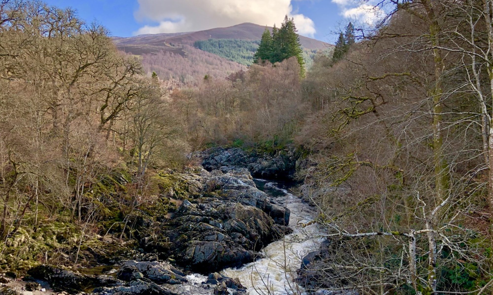
At a fork in the road, bear left to take the low road signed for Rachan. Shortly after this you will pass a building on your right then meet a wooden gate on your left (NT 13288 35356). Pass through the gate and descend to the former Peebles to Biggar railway line at the confluence of the Biggar Water and the Tweed.

The Symington, Biggar and Broughton Railway, to use its full name, opened in 1860 to connect these towns to what is now the West Coast Main Line. In 1864, it was extended east to Peebles where it joined the Peebles Railway. The trains that ran this line were known as the Tinto Express, but the envisioned passenger numbers never materialised and the line was closed in the 1950s. Today the route remains intact in places, but in others the land has been reclaimed for various purposes.

Follow the course of the line west along the side of the Biggar Water. A bridge crosses above the road at Rachan before passing through more rugged terrain to a second bridge, this time crossing onto the opposite bank of the river.
As you approach the village, leave the railway as it continues towards Biggar and cross the river once more via a small wooden footbridge. Turn left at the road on the other side to reach the village, where you need only continue along the main street to reach the village hall where the walk began.
This was a nice little walk into the hills, although it was rather blustery walking along the ridge. Down by the Hollows Burn, I could almost imagine that I was following in the footsteps of Richard Hannay evading the authorities in one of Buchan’s spy novels.
Before I set off, I was a little wary of the condition of the old railway line – though it looked fine from satellite images, it isn’t a recognised path. Previous walks have shown that the viaduct at Thornielee further down the Tweed is long gone, but fortunately the bridge across the Biggar Water remains intact.
My worries weren’t entirely without reason, however – holes in the stonework would lead to a swift plunge into the river if I wasn’t careful! I was informed, however, that the bridge is to be closed for repairs, although its status as an “unofficial” path means that unfortunately there isn’t council funding available for the project.